
While Michigan’s new congressional map looks even on paper, the final results could be skewed toward Republicans, thanks to a positive political environment.
Currently, the Michigan congressional delegation is evenly divided, with seven Democrats and seven Republicans. But that won’t be the case for much longer, as the state lost a congressional seat during the decennial reapportionment process due to sluggish population growth, dropping from 14 representatives to 13 (down from a peak of 19 seats in 1980).
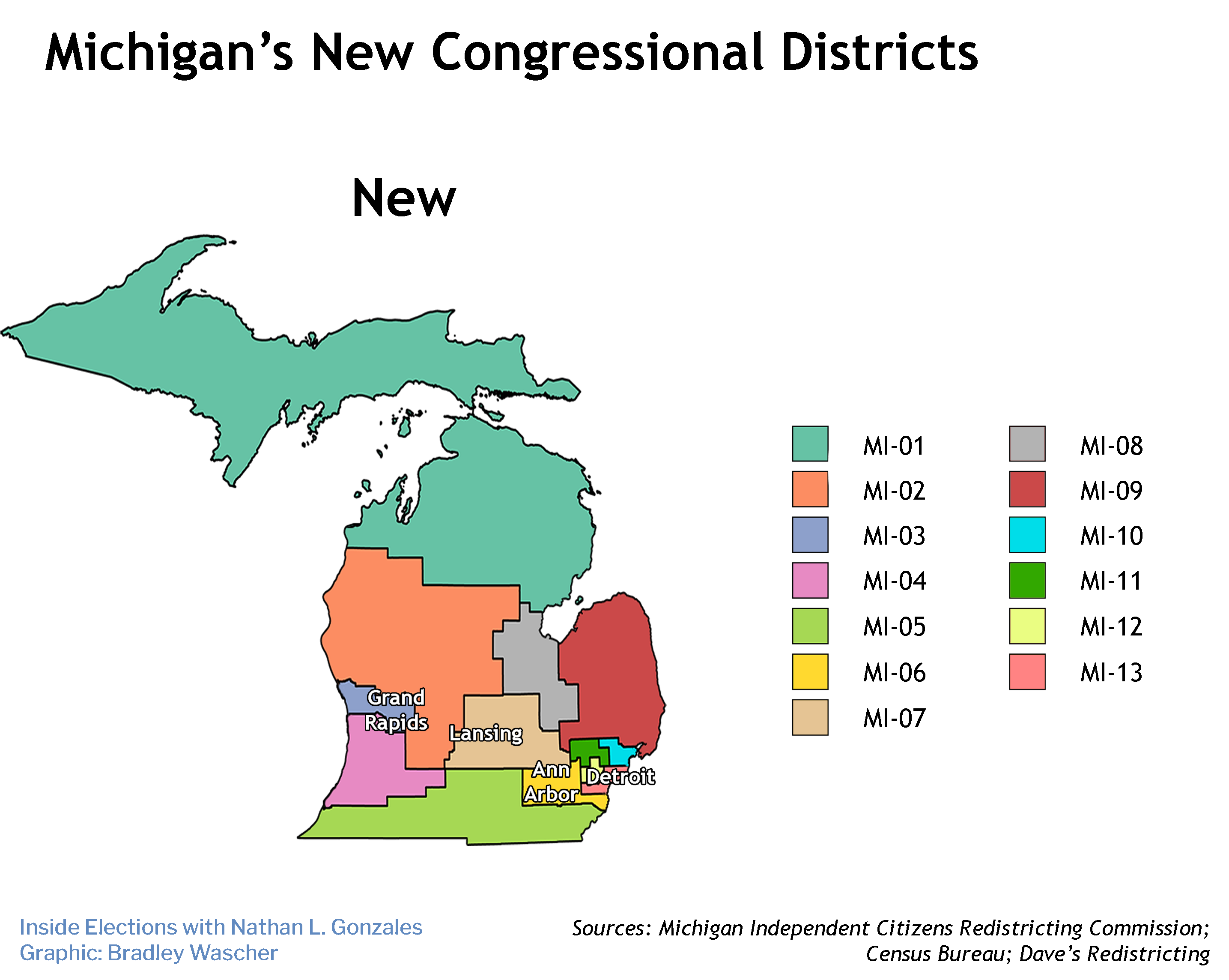
And following Michiganders’ approval of a redistricting initiative in 2018, the new congressional map was drawn by an independent commission rather than the state legislature.
Unlike most other independent commission states, Michigan relied largely on random selection to choose its commissioners (four Democrats, four Republicans, and five unaffiliated voters). While the commission had some stumbles early on, it ultimately approved a map with eight votes — two Republican, two Democratic, and four unaffiliated — that reflects the state’s closely divided partisanship.
In 2020, Joe Biden would have carried seven of the 13 new districts as he won the state 51-48 percent, while President Donald Trump would have carried six. Under the old map, Trump carried eight of the state’s 14 districts despite losing by 3 points.
But in the immediate term, with an unpopular Democratic president in the White House, Democrats could see a net loss of as many as two seats, complicating the party’s already-narrow path to retaining its slim House majority.
All population redistribution figures are courtesy of Daily Kos Elections.
1st District
The 1st District is still the entire Upper Peninsula, though it extends slightly further downstate. Trump would have carried it, 59-39 percent. Democratic candidate Bob Lorinser has...